13/10/2026
After the initial impact, the scale of an event and the urgency to publicize it can cause a plethora of news and opinion that is difficult to interpret. On this occasion, we want to pause, take a step back, and analyze an event that generated great media noise.
The DANA (technically known in English as an Isolated Depression at High Levels) that struck the Spanish Levante in October 2024 was an exceptional weather episode. At certain points, 185 l/m² of rainfall were recorded in one hour and 770 l/m2 in 24 hours. The stationary nature of the storm system caused the rainfall to persist for hours, generating flows that far exceeded the periods of return usually considered.
However, the magnitude of the weather phenomenon alone doesn’t explain why it became a catastrophe. Its consequences are also conditioned by the territory it impacts, the topography and composition of the terrain, and the capacity for anticipation and response. An extreme natural phenomenon can become a catastrophe when it coincides with an exposed and vulnerable territory.
The DANA caused serious damage to homes, roads, transportation networks, and other essential infrastructure. Alongside Víctor Yepes Piqueras, professor in the Engineering area at the Universitat Politècnica de Valencia (UPV), we analyze what happened, what factors aggravated its effects, and what we can learn from it.
The territory is also part of the risk
As Yepes explains, the main vulnerability of the territory didn’t respond to a single factor, but to the combination of a high population exposure, economic activity, and infrastructure in potentially flooded areas, along with the characteristics of the drainage and transportation network and the extraordinary magnitude of the avenue.
In regions like l’Horta Sud, the urban and industrial growth accumulated over decades occupied part of the natural floodplains and the dry riverbeds of the ramblas. This process also involved replacing vegetated surfaces with impermeable ones, promoting a faster runoff response and reducing water infiltration.
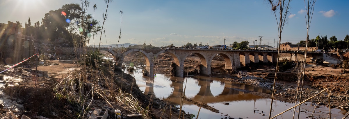
The infrastructures themselves can also alter how water behaves. Some bridges with pillars located in the road or certain road and railway channels can cause localalized narrowing. If vegetation, sediments, vehicles, debris, or other materials carried by the water also accumulate, the available section can be temporarily reduced and upstream levels can increase.
To analyze how these damages occur, the expert proposes applying the so-called “Swiss cheese model,” a representation used in risk analysis that suggests serious impacts can happen when multiple weaknesses coincide across different layers of protection. In this episode, pre-existing territorial and hydraulic factors converged with circumstances inherent to the emergency.
Among them are the characteristics of certain basins, with rapid response times and limited hydraulic capacity in the face of extraordinary events. The response can also be different in infrastructures designed to regulate or channel flows, such as the new Turia riverbed or the Forata dam on the Magro river, whose specific contribution must be analyzed based on their operating conditions and the recorded flows.
Other factors related to the transmission of information and the perception of risk were added to the physical factors, such as the limitations of early warning systems and the level of awareness of the danger by the population.
When historical records aren’t enough
This perspective also raises questions about the tools we use to calculate risk. One of the main ones has to do with the so-called climate stationarity: the idea that past data and records allow estimating with sufficient accuracy the frequency and intensity of future phenomena. In a context of climate change, this assumption may cease to be adequate for certain types of analysis.
The return periods commonly used also don’t necessarily reflect all the situations that a changing climate can cause. The episode also raises the need to better represent those situations in which extreme rainfall arrives after several episodes of precipitation that have already saturated the soil, favoring rapid increases in flow.
It’s also necessary to pay more attention to the geomorphology of Mediterranean alluvial fans and plains. In these areas, the water doesn’t always follow the behavior of a large river: the canal can lose capacity as it progresses and the overflowed water can seek other routes and flow through secondary channels.
The interaction of water and infrastructure adds to the complexity. Models may have difficulty representing in sufficient detail what happens when vehicles, sediments, vegetation, or debris accumulate on bridges and lower steps. The hydraulic modeling after the DANA precisely shows the usefulness of analyzing not only the extent of flooding, but also its dynamics, speeds, and its interaction with the main transport infrastructures.
The experience also points to better leveraging the available data during an emergency. A measurement network like SAIH (Automatic Hydrological Information Systems) provides valuable information that could be integrated with hydraulic models capable of transforming precipitation and flows into dynamic flood maps and facilitating real-time management.
Risk analysis shouldn’t focus solely on each infrastructure in isolation. The electricity, water, telecommunications, and transport systems are all interconnected, so the interruption of one can affect the functioning of others. Identifying these possible chains of effects is fundamental to better prepare both the emergency response and the subsequent recovery.
Design for all possible scenarios
Another of the lessons learned from the DANA is that infrastructure shouldn’t be evaluated solely under the conditions for which it was designed: it’s also necessary to analyze how it would behave when the phenomenon exceeds those hypotheses, what functions it could maintain, and what its possible failure modes would be.
This is especially relevant because many infrastructures have useful lives of several decades. Designing them solely based on historical conditions may not be sufficient if future weather conditions are different. One possible approach is to move towards Performance-Based Design criteria and probabilistic risk modeling, periodically reviewing the intensity-frequency curves and the design hypotheses as new data becomes available.
The goal shouldn’t just be for a structure to withstand a certain event, but also to preserve, as much as possible, its essential functions and recover them quickly after an emergency.
This also requires looking at infrastructures as a whole system. Electricity, water, telecommunications, and transportation are interconnected, so the failure of one can hinder the operation or recovery of others. The risk must therefore incorporate possible cascade effects and the times needed to recover services.
Give water the space it needs
Engineering has different tools to reduce the risk: dams and baskets, drainage works, emergency channels, protective infrastructures, among others. But there is no infrastructure capable of guaranteeing security entirely on its own. Hence the importance of a concept repeated by the expert: give space to the water. It means recovering, when the conditions of the territory allow it, places where water can circulate, spread, or be temporarily stored instead of always trying to contain it within a channel.
In practice, this can translate into recovering floodable areas, expanding certain river spaces, creating floodable parks, improving soil permeability, or using Sustainable Drainage Urban Systems (SUDS). These measures can be combined with traditional infrastructures – it’s not about replacing one with the other, but about configuring different layers of protection.
But limiting oneself to traditional hydraulic structures can create a false sense of safety. Relying on a single dam, wall, or channel, or maintaining vulnerable uses because there is a defensive structure, or rebuilding infrastructure exactly as it was without reviewing whether its configuration is still appropriate. A one-off action can solve a specific problem, but not necessarily the functioning of the entire system.
Rebuild thinking about the next episode
Reconstruction requires distinguishing between recovering affected services and correcting the conditions that contributed to the vulnerability in the first place. Repairing a road, a bridge, or a network allows operations to be restored, but it doesn’t guarantee that the infrastructure will respond better to a future episode. Therefore, the replacement works also offer the opportunity to review, when the technical studies justify it, the calculation criteria, drainage conditions, and the location of particularly sensitive uses.
As part of this process, it’s important to coordinate the actions of the different administrations and analyze the behavior of the system as a whole. It’ll also be necessary to take into account that many infrastructures have a useful life of several decades and that the weather conditions during that period may differ from those used for their design. This raises the need to periodically review the calculation assumptions and incorporate new data and future scenarios.
But what if an episode of similar magnitude were to happen again today? Some monitoring and alert systems might be better equipped to detect and communicate certain situations. The SAIH, civil protection notifications, and tools like ES-Alert could facilitate a faster transmission of the available information. It’s also reasonable to think that the experience of 2024 has changed the perception of risk both in the population and in the public administrations. However, an earlier warning doesn’t necessarily imply that the results are completely different: its effectiveness would depend on the available anticipation, the accuracy of information, and the capacity of the population and emergency services to act accordingly.
What would hardly have changed in this time is the physical configuration of the territory. Large hydraulic events, infrastructure modifications, and changes in urban management require years of studies, projects, processing, and execution. Although some actions are already underway, the floodplain of l’Horta Sud remains highly exposed and certain solutions are still provisional or ongoing.
The experience of the DANA shows, ultimately, that improving emergency response is only a part of reducing risk. The other involves acting on the physical and territorial conditions that determine its consequences. The challenge is not to prevent an extreme episode from happening again, but to ensure that when it does occur, it finds a less vulnerable territory and infrastructure capable of responding and recovering better
Article collaborator:

Víctor Yepes is Doctor Engineer of Caminos, Channels and Ports and Catedratics at the Universitat Politècnica de Valencia (UPV), where he researches and teaches about civil engineering, construction, and infrastructure management. He is a researcher at the Institute of Science and Technology of Hormigon (ICITECH) and has more than 200 scientific articles indexed in the JCR. His career combines research, teaching, and professional experience in the public and private sectors.
In the UPV blog, he addresses civil engineering and infrastructure management from an informational perspective, and has dedicated several articles to analyzing the causes, consequences, and lessons of the 2024 DANA.