24/09/2026
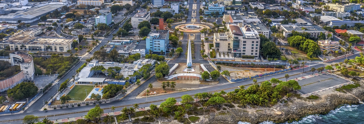
Santo Domingo was the first colonial city of the Americas. More than five centuries later, it combines a valuable historical heritage with vibrant commercial, financial, and tourism activity. This pulsating dynamic also exposes it to risks related to its geographic location.
Santo Domingo is one of the main tourist destinations in the Caribbean. The increase in foreign visitors to “La Capital” — as it’s known by the locals — has been accompanied in recent years by some crime problems, especially assaults in areas frequented by tourists. However, the reinforcement of surveillance and security devices has reduced their impact, so tourist safety isn’t one of the main risks in the city today.
Although public services and social protection remain insufficient, the Global Risks Report 2026 highlights that the Dominican Republic has maintained sustained economic growth over the past decades, with a clear improvement in living conditions.
In 2013 the authorities launched a comprehensive urban renewal program, financed by the Inter-American Development Bank, which has not only improved quality of life for the capital’s citizens, but has also expanded the range of accommodation, hospitality and leisure options.
These actions, along with the institutional stability the country enjoys, have considerably reduced exposure to political and social conflict. However, its insular status and location in the Caribbean mean that it continues to face significant natural risks, which require constant attention from the administrations.
Vulnerable to climate change
Exposure to extreme weather events has marked the history of the Dominican Republic, and this has intensified in recent years due to increase in the frequency and intensity of weather events associated with global warming, like tropical storms and floods.
The entire country is in fact highly vulnerable to climate change—including slow-onset processes such as rising temperatures or forest degradation— according to the World Bank. These impacts affect key sectors of the economy and society, particularly the most vulnerable populations.
Looking ahead to 2050, the agency anticipates that climate change will reduce labor productivity and harm health, crop yields, tourism, infrastructure, and natural ecosystems, such as forests and coastal zones. This scenario that will have a particularly significant impact in Santo Domingo, the largest urban area in the country, where 42% of Dominicans, some 4.6 million people, resides.
The growing intensity of these phenomena underlines the need to integrate climate risk management into public planning and investment spend in the coming years with the aim of strengthening the country’s resilience and reducing its economic and social vulnerability. To make this happen, national institutions will have to develop preventive and mitigation measures.
Exposure to hurricanes
Scientific evidence points to the fact that global warming is modifying the behavior of hurricanes, favoring more intense rainfall, and increasing the energy available for these phenomena due to the increase in the temperature of the oceans. This evolution, along with natural climate variability, complicates forecasting their impacts and raises the potential for damage.
The Dominican Republic is also located in the middle of the Atlantic hurricane corridor, where ideal conditions for the formation of tropical cyclones converge. Add to this is a warm and wet climate and a rainy season that goes from May to November, and you have a set of circumstances that favor the evaporation of seawater, one of the essential ingredients a hurricane needs.
Hurricanes have caused serious damage to the Dominican population throughout history. Hurricane David (1979) caused the deaths of more than 2,000 people and destroyed nearly 70% of the country’s crops. Years later, Hurricane Georges, (1988) left nearly 300 dead and economic losses exceeding 2 billion dollars.
Heavy flooding
The tropical storms associated with hurricanes usually cause torrential rains that produce landslides, which in turn cause rivers to burst their banks, resulting in major flooding throughout the island of La Española, where Santo Domingo is located. Even weather systems that don’t directly impact the Dominican territory can produce very intense rainfall and cause relevant effects.
However, floods occur throughout the year and aren’t always linked to tropical cyclones. In April of this year, heavy rains forced about 30,000 people to relocate, damaged around 100,000 homes, and affected critical infrastructure in different parts of the country.
In Santo Domingo, high urban density also favors the emergence of specific microclimatic conditions. Notable among them is the urban heat island effect, whereby temperatures are higher than in nearby rural areas due to heat accumulation in buildings and paved surfaces. When this phenomenon coincides with high humidity levels, it fosters the formation of convective clouds and particularly intense rainfall, which is why coastal tropical cities like the Dominican capital have suffered particularly destructive episodes, such as those recorded in November 2022 and 2023.
Experts also warn that Santo Domingo’s urban growth has outpaced the development of its infrastructure. The expansion of large neighborhoods without rain drainage systems designed to support this population density has increased both the frequency and the severity of flooding.
Measures taken
In response to this situation, in 2024 the Adaptation Plan for Flooding Influenced by Climate Change in the Colonial City of Santo Domingo was launched. The program includes measures such as the implementation of urban water catchment systems, percolation drainage, and the rehabilitation of roadways to increase soil permeability in the historic center.
Likewise, the government of the Dominican Republic has significantly strengthened its preparedness against these phenomena through national contingency plans that are reviewed every year. The 2026 update incorporates new meteorological monitoring infrastructures, a network of more than 2,700 shelters, special protocols for deploying drones, video surveillance systems, and reinforcement of radio communications, as well as interinstitutional coordination involving more than 20 public agencies.
The country also has a specific body in place to coordinate prevention and response to major emergencies: the Emergency Operations Center (COE), which reports to the Ministry of the Presidency. This agency plans and directs disaster preparedness, response, and recovery action plans, issues official alerts, and coordinates the joint action of public institutions, private entities, and emergency services in response to natural events.