“Earthquakes cannot be predicted, here or anywhere else in the world.”
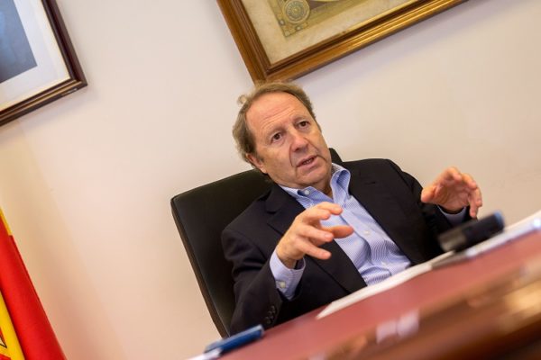
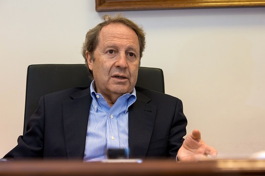
After completing his studies in Physical Science at the Complutense University of Madrid, Emilio Carreño began working at geophysics companies related to insurance and reinsurance. In the mid-1980s, he joined the National Seismic Network, an institution he has directed since 2000. With his vast experience and broad knowledge of the insurance industry, he talks to us about the current situation of seismic activity.
- To give us some background, tell us about the National Seismic Network.
We are a Government agency, and our primary job is to detect and report all seismic activity that occurs, not only in Spain, but also in North Africa. We are responsible for providing the official parameters used to assess an earthquake: magnitude, location, depth, etc.
The first recipient of all that information is the Department of Civil Protection and Emergencies, because it is undeniable that an earthquake has a social impact. However, the notes we gather are also essential to learning more about the Earth. Without those movements and all the data recorded, we would not know that there is an inner core, an outer core… The knowledge we receive is immense, because geomagnetic tests do not give use enough. We cannot make a hole to see what’s inside. We know about it thanks to the propagation of seismic waves.
2. What instruments are available today, and what jobs are a part of your work?
We have an increasing number of technical resources, so our work, which was initially limited to detecting these events and their location, has increased exponentially. First, we have had to add seismicity studies and studies measuring the effects of man. We keep an extremely close eye on many reservoirs, especially during construction and filling, because there may be seismic activity associated with these phases.
There are also important studies related to underground gas storage facilities. Every country is required to have gas reserves; in Spain, there are many storage locations, and some of them could cause problems. That is why we have continuous reports, and we have managed to require the companies that undertake these engineering projects to install specific control networks around their operations; networks that, in most cases, we also monitor and analyze, which enables us to provide exhaustive reports.
We have an increasing number of technical resources, so our work, which was initially limited to detecting seismic events and their location, has increased exponentially. We keep an extremely close eye on many reservoirs, especially during construction and filling, because there may be seismic activity associated with these phases.
We have another line of action at our primary station in the international monitoring system, located in Sonseca – 37 kilometers from Toledo – where we help ensure compliance with the United Nations-sponsored ‘Treaty on the Non-Proliferation of Nuclear Weapons,’ based in Vienna. The detection systems there can reveal whether a country is conducting nuclear tests, in any situation.
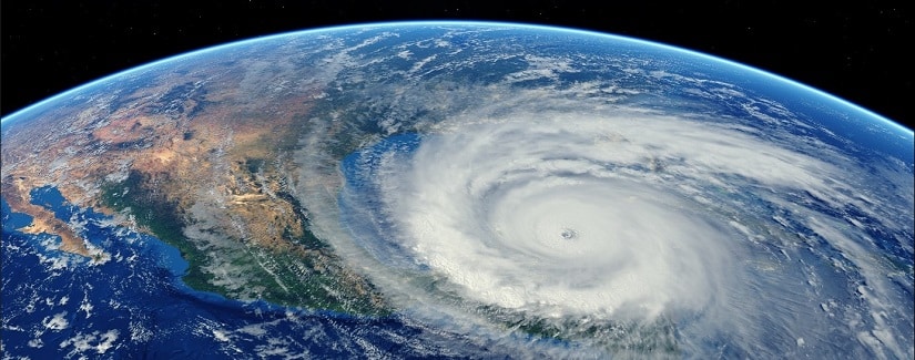
Finally, for a few years now, we have been responsible for the National Tsunami Alert Network. Although this phenomenon may remind us of the Caribbean or Indonesia, the greatest natural disaster Spain has experienced was the tsunami of 1775, triggered by the Lisbon earthquake, which created waves up to 12 meters high that affected a large part of the Andalusian coast.
3. What do you contribute to construction regulations?
Our responsibility in the regulation of earthquake-resistant construction is very important, because it is established through a standing commission presided over by the National Geographic Institute. The National Seismic Network also provides a seismic hazards map.
4. Is it possible to precisely and reliably predict seismic activity? How has scientific and instrumental knowledge advanced in recent years?
Earthquakes cannot be predicted, here or anywhere else in the world. We are coming very close to prediction in certain areas where there is major seismic activity – in countries like Chile or Japan, for example, where the tectonic plates move at speeds that cause displacements of around 58-60 millimeters a year, which is a lot. But, why are we close to being able to make predictions in these areas? Because the development of GPS in recent years has been so significant that it can detect movements almost instantly. Knowing that, it is possible to calculate more or less which line will break, the magnitude of the earthquake, and when it will occur.
5. Seismic events are natural phenomena that go beyond borders, affecting different parts of the globe. Latin America is one of the areas that tends to suffer the consequences. With whom do you collaborate in that region and how?
 On the one hand, collaboration is global, because we have access to the information generated by any station around the world in real time. But we also have other types of initiatives, such as those we conduct with CERESIS (the Regional Seismology Center for South America), with which we have given a course on creating a hazards map, with students participating from 15 American countries.
Earthquakes cannot be predicted, here or anywhere else in the world. We are coming very close to predictions in some areas where there is significant seismic activity – in countries such as Chile or Japan
6. What characteristics of assets (buildings/constructions, etc.) are determinant for the level of earthquake-related losses?
Construction regulations are designed to prevent loss of human life, and that is achieved by preventing building collapses. This regulation was established due to the consequences of the 1985 Mexico earthquake, when many modern buildings collapsed. Now we are trying to analyze the ductile materials used, and to regulate construction processes to prevent collapse.
Spain was one of the first countries to apply construction regulations, due in large part to our history in Central America, South America, and the Philippines, where seismic activity is high. Specifically, in 1884, following the great earthquake in Andalusia that resulted in over 1000 victims, the King set up aid for the citizens who had to rebuild their homes and the obligation to do so in accordance with regulations that required a particular street width, building height, and separation.
The current regulations were passed in 2002, although there is a code that is about to be published that will standardize criteria throughout Europe, although there will be appendixes with the characteristics of each
7. What parameters are taken into account when assessing the effects of seismic movement?
There is a fully-defined European regulation – the macroseismic scale, which specifies what percentage of buildings and what type of construction has to have suffered damage of the total to classify it as one level or another.
8. As a specialist in Natural Risks, how do you think insurance hedging has changed to respond to the current situation?
The situation in Spain is a special case because of the Insurance Compensation Consortium, which does an outstanding job. First, because they are very diligent when compensating those who have suffered damage. And second, because they have very efficient appraisers. In addition, the insurance industry, and especially companies that have interests in other countries – most of all in Central America and South America, is at a very high level. 1) How can we reduce the risks, damage, and costs (human and financial) of earthquakes, and what agents or scenarios would be required?
9. The Seismic Network collaborates closely with the insurance industry by providing information, among other things. Could you tell us about this cooperation and what you each contribute?
We work together with both the Consortium and with some companies, such as MAPFRE. They offer advice on engineering issues that help us carry out public information projects. We try to answer any questions we receive, sharing all the data they may need to carry out their activity.
10. Although there are no geological reports that confirm it, it is believed that there is a relationship between climate change and the increase in earthquakes. Do you believe there is really any connection?
My stance is the same as the major Reinsurers, who have experts who are very well prepared and highly professional – as well as a lot of interest in determining whether or not that change really exists – and these companies have done very serious studies and have determined that there is no relationship. The number of major earthquakes has not changed over the years, and no relationship has been found with climate change.
11. Are we experiencing an increase in seismic activity, or are the levels normal?
Se dan dos circunstancias: primero, que hay más y mejor instrumentación -aquí y en cualquier país del mundo-, con lo cual muchos terremotos que antes no eran sentidos por la población , y por lo tanto pasaban desapercibidos, ahora son registrados. También hay que tener en cuenta la visibilidad que se da a los eventos, sea cual sea el lugar en el que se produzcan. Ahora podemos estar viendo la llegada de un Tsunami a la costa de Indonesia por la televisión y en tiempo real, y eso genera una sensación en la sociedad de que se producen muchas más catástrofes que antes.
España es, además, un caso curiosísimo: pese a la baja actividad sísmica que tenemos, el año pasado se hicieron más de 30 millones de consultas en nuestra web. De hecho, contamos con un cuestionario a disposición de cualquier ciudadano, con el que pueden hacernos llegar sus impresiones, e incluso después de un mínimo temblor en una población muy pequeña nos pueden llegar hasta 200 o 300 cuestionarios en una hora. Hay un interés enorme por todo lo relativo a los terremotos y se traduce en colaboración ciudadana, porque nos dan información constante. Pero España es un caso único.
We work together with both the Consortium and with some companies, such as MAPFRE. They offer advice on engineering issues that help us carry out public information projects.
12. How can we reduce the risks, damage, and costs (human and financial) of earthquakes, and what agents or scenarios would be required?
There are really good studies being produced in our country on the hazards in each autonomous region, and that indicates the level of activity we could have in a particular location, whether or not there are buildings exposed. From that point of view, the territories are very well studied. The problem is that we also need seismic risk studies that evaluate vulnerability and cost in addition to the hazards. That could be done in small towns, using a registry of all the buildings, but that would be extremely complicated at the national level.
Emilio Carreño, Director of the National Seismic Network
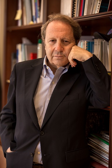
Emilio Carreño Herrero (Segovia, 1950) studied Physical Science at the Complutense University of Madrid. He started his career at geophysics companies, and has worked with insurance and reinsurance companies. In the mid-1980s, after passing the examination for the National Corps of Geographic Engineers, he joined the National Geographic Institute.
Within the administration, he has held different positions of responsibility, including management of the Sonseca Seismological Center, a station that monitors compliance with the ‘Treaty on the Non-Proliferation of Nuclear Weapons’ in a mission coordinated by the UN that enables, through meticulous surveillance, the detection of nuclear testing in any country.
In 2000, he was appointed Director of the National Seismic Network, a position he has held since then. Throughout his career, he has written a number of books and publications on seismology, radar interferometry techniques, and satellite image analysis applied to geophysics. In recent years, he has collaborated with the Insurance Compensation Consortium and MAPFRE to create general informational material on earthquakes and tsunamis.